|
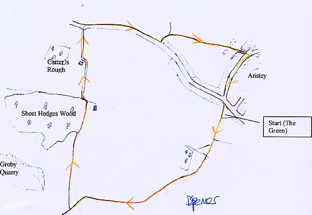
Take the footpath from the corner of the
Green furthest from the road. Walk along this past the farm buildings and
carry on, ignoring the footpaths to the left and right, and then the
crossroads, until you walk down a steeply sloping field (which can be muddy)
to a junction. Turn right here, and continue along this path, keeping the
Quarry on your left. Walk alongside Sheet Hedges Wood, until you reach the
corner.
Turn left here, then right along a track,
which bends to the left then right passing some farm buildings, (can be
muddy here) eventually reaching the road. Turn right, and walk along the
road for about 600m, until a footpath signposted "Bradgate Park", just
before the houses.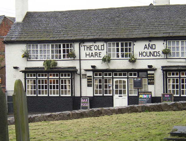
Walk along this footpath, turning right
when it splits. Cross over a bridleway, and continue towards the village.
When you reach the road, turn right, and return to the start.
If you want a drink, turn left onto Bradgate
Road at the Green and continue along the road down to the village centre.
There are a variety of pubs in the village, including the Plough (on the
left of the road), and the Hare and Hounds (on the right opposite the church
- pictured right) |