|
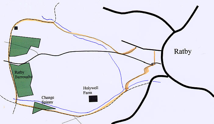
Take the footpath on the Left Hand side of the
road (not the first footpath on the road, the second one, about half way up
the road). Walk along this path until you reach a road. Turn right along
this road, and walk for about 150M. Take the footpath that branches off to
the right. Keep on this path until you reach a farm track, and turn left
onto it. Keep on this track, going
round past some farm buildings and a wood. Cross over a footpath and a
track, and continue past the woods. At the end of the woods, you reach
another track, after crossing over a stream. Turn left here, passing through
a spinney. Ignore the paths off to the left. Keep on this track as it
follows the line of the river, passing a Farm off to the left. Keep going
until you reach a footpath on the left. Walk along this back to Burroughs
Road. Cross over here and walk through the park back to Stamford Street.
Turn left here and return to the start.
|
|
©Leicesterwalk 2002 - Map drawn by Daniel Spencer for Leicesterwalk
This walk was written by Daniel Spencer for
Leicesterwalk. Any comments about this walk should be sent to
daniel.spencer@ileicestershire.zzn.com
Please feel free to let me know how you got on.
Disclaimer - We cannot accept responsibility
for any loss or injury caused during walks found on this site. Whilst we
make every attempt to ensure accuracy of information, rights of way or
landmarks may move or change. We advise you always carry the relevant OS map
with you.
|