|
The Leicestershire Wolds and Soar Valley
Landmine Awareness Route - By Gwilym
Thomas
|
Information |
|
Distance:
15 miles |
Time: 6-7 hours (plus stops) |
|
Suitable For: Competent Walkers |
Terrain: Some steep slopes, but mostly undulating. Stiles, stepping
stones and bad patch of nettles (June 2003) |
|
Difficulty: Hard |
OS Map: Explorer 246 |
|
Starting Point: Loughborough Market Place (436 196) |
Parking: Car parks in Loughborough (Multi Storey: Carillon court,
Beehive lane - signposted, Free: Leicester Road, near council offices).
PLEASE DO NOT PARK AT THE ENDOWED SCHOOLS. |
|
Toilets: Loughborough Market Place (various pubs en route) |
Refreshments: See author's comment. |
|
For driving
directions to the start of this walk, please CLICK HERE |
|
The Walk |
|

Starting by McDonalds
on the High Street, turn up Baxter Gate and walk past the bus shelters and
the bingo hall. Turn left onto Sparrow Hill and walk round the back of the
Parish Church. Bear right and cross the B589 and A6004. Head north on
Meadow Lane, crossing the railway, then
continue with the FKI/Brush works on your right. Soon after the end of the
works, cross a small bridge on the road and then head immediately onto a
footpath to the right. Of the two paths, take the one that heads under the
railway, and over two bridges across the River Soar. Take the northernmost
path on to Stanford Lane.
Cross the lane. You
need to take the path on the south side of the field boundary, along the
King’s Brook and past Black-a-Moors Spinney. At the junction of four paths
turn right and join the A60 Rempstone Road at King’s bridge. Cross the road and continue the path, this time on the
left- hand side of the field boundary. This path continues to Wymeswold.
When you reach London
Lane in Wymeswold, turn right. At the end of this road, turn left onto Hoton
Road and take the first right from here. Now heading south you should pass a
brick scout hut, and soon after cross the road and follow a path diagonally
across a field and south onto the B676, past Cliff Farm.
On the B676 head west
into Burton-on-the-Wolds. At the mini-roundabout turn left. Soon after
passing a school to your right, turn left down a track towards Walton. Once
in Walton, head South, following the main road round the corner, past The
Anchor pub. Climbing up the hill take the second right and walk past the
church. Take the path to our left. Coming out through a small wooded strip,
turn left along a bridleway and head down the hill and over Fishpool Brook.
Follow the path up the other side of the hill and along the track past Quorn
Park.
Cross Melton Road and
continue along the bridleway until it turns into a field. From here take the
path that branches off to your right, towards Barrow. Where five paths join,
take the one that heads almost due west, into Barrow. Coming out on the
road, turn left, and follow it to its conclusion. Here turn left, across the
railway, and then right at the end. Cross this road and continue down to the
roundabout, and take Barrow Road, down to the canal and river. Once over the
canal and causeway, turn right on a path towards New Hayes Farm, and then
right onto Flesh Hovel Lane.
Immediately after the
sewage works, turn left, and head on the path towards the lake. Once past
the lake, turn left onto the track, towards the A6 and Bull-in-the-Hollow
Farm. Turn north on the A6, through Loughborough and to the marketplace.
VARIATIONS:
Obviously, you could
start almost anywhere on the walk. Alternatively, after Barrow, you could
take the canal path into Loughborough, but this was not used for the walk in
question because of safety issues and the fact that we did not start the
walk in the market place, but at the Endowed Schools further down the A6
|
|
Author's Comment
I planned this walk for the
Landmine-Awareness Sponsored Walk, and at 15½ miles it is not a short
stroll!
There are a few points
to watch out for. On the section between Stanford-on-Soar and the A60 there
is an area where nettles, brambles and thistles are a serious problem.
Although the area has now been cleared slightly, it is best to wear long
trousers and long sleeves. An added precaution is to put on your waterproof
trousers- this keeps the nettles at bay- but do not snag them on thistles!
The best time to start
the walk during the summer, is around 1 o’clock in the afternoon. This means that you can be walking through the cooler
evening.
And now to
refreshments. It all depends where you start and what you have eaten
already. There are pubs in Wymeswold and Burton-on-the-Wolds which are
slightly off the route. The Anchor in Walton, as well as pubs near the canal
in Barrow, are virtually on the route. There are also nice places in all the
villages to eat a picnic.
Another word, make sure
you have enough water, our group of six got through over 14 litres! But this
area of Leicestershire did break the year’s records for temperature during
the walk, and they didn’t rise much more over the rest of the summer. As
there is no way a group of hikers could carry this much, we recommend you
stop and buy some on the way, or have a support vehicle. If you are walking
during the summer, this is essential.
Finally, it’s not a
great walk for hay fever sufferers, especially in the summer. There are a
couple of field of oil-seed rape and other irritant crops. This walk is not
for the faint hearted - but have fun if you do undertake it!
|
|
 While
you are walking, please spare a thought for those who, due to
landmines,
are no longer able to walk. Once every 20
minutes someone is killed or maimed by a landmine. 40% of landmine victims
are children, and only 5 to 10% are soldiers. These mines are claiming lives
as you read this. Mines destroy communities physically, socially and
economically. For these people daily tasks, like fetching water, have been
made impossible. These people have lost everything, and you can make a
difference to them. Visit
www.landmine-awareness.net to find out how. While
you are walking, please spare a thought for those who, due to
landmines,
are no longer able to walk. Once every 20
minutes someone is killed or maimed by a landmine. 40% of landmine victims
are children, and only 5 to 10% are soldiers. These mines are claiming lives
as you read this. Mines destroy communities physically, socially and
economically. For these people daily tasks, like fetching water, have been
made impossible. These people have lost everything, and you can make a
difference to them. Visit
www.landmine-awareness.net to find out how.
Landmine-Awareness is
an organization that has been set up to increase awareness of these terrible
weapons in the area. Landmine-Awareness also donates funds to
Adopt-A-Minefield, a charity set up by the United Nations Association.
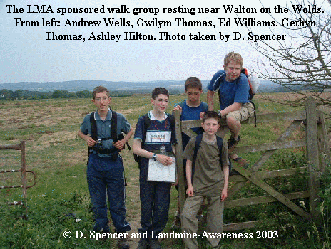
This walk raised over
£600 for the charity. Those walking were Ashley Hilton, Daniel Spencer,
Gwilym Thomas, Gethyn Thomas, Andrew Wells and Edward Williams. Roy Spencer,
Alan Thomas and Chris Wells drove the support vehicles.
Gwilym Thomas
|
|
Editor's Comment This walk was written for the landmine awareness
by Gwilym Thomas, and he has also submitted this walk to the Leicesterwalk
Website... so thanks go to him. I have walked this route myself, but that
was in June 2003, so things may have changed. Please remember that neither
Leicesterwalk, nor the author of the route nor any associated bodies can
accept any responsibility or liability for loss or injury occurring as a
result of this walk.
Please visit Landmine Awareness - it is a worthy cause, and one which I
fully support. If you have any feedback on this walk, please
email Leicesterwalk, and your message will be passed on to Gwilym.
D. Spencer
|
|