From the Market Place, head down past
the Town Hall and Cinema to Ward’s End. Follow this until you come to a
small car parking area at a junction. Cross over two pedestrian crossings
until you are outside a public house. Follow this road with the one-way
traffic to the junction at the end. Cross over at the junction, turn left
and then the first right. Follow this road down until a roundabout. This is
the A6004, Epinal Way. Go straight over onto Beacon Road. Follow this down
to its end. Cross straight over and you will find yourself on a track.
Follow this track through until the path forks. Follow the right fork. This
should take you uphill and into some woods. You are now at the Outwoods.
Now, follow the path that takes you West, following it uphill until the car
park.
Walk out of the car park, turn right along the road for 350m or so. You
should pass a house on your left, Charnwood Hall. Cross over straight
afterwards. You will find a small private path. This closes at dusk*. Follow
this path through, generally westwards until you reach Wood Brook. Cross the
stream. The path follows the left field boundary uphill and to your left.
Cross two field boundaries. Shortly before the third there is a gate and a
path leading uphill to your left (roughly south-east). After the gate you
cross Wood Brook again, and walk up the hill. The hill is steep, with an
average gradient of 1in7. Arriving at the top of the hill you should reach a
road, Dean’s Lane.
Cross over and through the Beacon Hill Country Park gate. Follow the path
uphill. You will meet a bridleway. To approach the summit, bear left, for
the car park walk along the bridleway.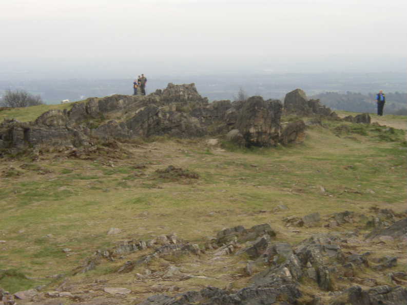
This is an ideal place to stop and enjoy a picnic lunch. Afterwards, head
from the car park towards the summit (pictured left). Immediately after
reaching the gate and boundary turn right. Follow the marked path downhill.
You will enter some woodland. Soon after leaving this there is a path that
leads to the right, Beacon Road and Woodhouse Eaves. Follow this parallel
with a field boundary until you reach the road. Cross over and head into
Woodhouse Eaves.
Before reaching the village you will arrive at the Broombriggs Farm car
park. Turn right, across the car park and through a gate. Follow the main
path over the hill summit. After some woodland the path turns in to a road.
Follow this down until you reach another. Turn left along this road until
you reach offset cross roads. Head straight on (NW). Follow the
Leicestershire Round along the road until a bend, across a field and across
a road. Continue along the Leicestershire Round. About level with the end of
the buildings of Rushey Fields Farm. Turn left along the track. Turn left
along another track into Woodhouse.
Turn right when you reach the road. Soon after the village there is a
sharp right turn in the road. Cross over. The footpath is marked and is
through the gate. The path then traverses three fields and arrives at a
track. Turn right through Woodthorpe. At the roundabout on the bypass go
straight over. The bypass is a new road and is not on the current Explorer
map. There is a small track (soon to be closed off to vehicular traffic)
that runs towards the A6 over the Great Central Railway. Before you reach
this there should be a footpath to your left. Follow this until it joins
with a track partway through the cemetery. Follow this track onto the A6,
past a cricket ground.
Turn left up the A6(N/NE)Follow the road right into the town centre. Turn
left into the market place (opposite McDonalds). This is the end of the
walk.
* - If the path is closed, retrace your steps along the road, passing the
outwoods car park again. Then turn right into Deans Lane, and rejoin the
route.
 I
have not as yet had a chance to walk this route, although I know some of the
footpaths from other walks. However, I am assured that the author recently
walked this route. I request that while walking on the private path, you
respect the owners property, do no damage and avoid invading the owner's
privacy, so that the path can continue to remain open.
I
have not as yet had a chance to walk this route, although I know some of the
footpaths from other walks. However, I am assured that the author recently
walked this route. I request that while walking on the private path, you
respect the owners property, do no damage and avoid invading the owner's
privacy, so that the path can continue to remain open.